Rural Rights of Way (or Public Footpaths) in Milton Damerel
In the early 1900’s there were around 25 rural footpaths throughout the Parish. Their purpose was not recreational use, but as a means of getting around the Parish in the days before the advent of the motor car, when the primary form of transport over short distances, at least, was by walking. Some of the tracks were also about moving produce such as millers’ tracks from farms to mills etc. Hence many of these paths ran from pockets of habitation to farms which were the major sources of employment at the time. They also went to churches, schools and shops, taking the most direct routes possible, in order to cut down on journey times. FP 1 probably originated to allow the vicar/rector to walk from the original rectory to the Church. In the 1950’s and 60’s when the car became ubiquitous and farming more mechanised and needing far fewer workers many of these footpaths fell into disuse and over the years have now been ‘lost’. Today, with people having more leisure time available, interest is being generated in rural footpaths for recreational walking, to enable them to get away from traffic and out into the peace and tranquillity of the countryside
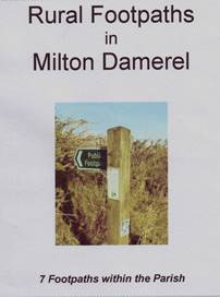
There are 7 of these short footpaths remaining within our Parish, none of which is more than ½ mile (0.8 km) in length:
No. 1 Glovers Cottage to Worden Cross
No. 7 Whitebear Cross to Lower Walland Gate
No. 12 Gidcott Mill to Halsepark
No. 15 Whitebear Farm to Chapel View
No. 16 Whitebear Cottage to Holy Trinity Church the Methodist Chapel
No. 21 Waldon Farm via Heddon Farm to Sutcombe (1)
No. 24 Milton Mill via North Town to Butterfly Lane (2)
(1) The parish boundary is the River Waldon which is crossed by a footbridge and from there to Sutcombe it continues under a different footpath number.
(2) The first part of this path has recently been re-aligned and therefore does not follow the route marked on the various O/S maps.
The routes are marked on the Ordnance Survey maps which cover the Parish. Sheet 126 of the Explorer series (scale 1:25,000 or 2½ inches = 1 mile) and sheet 190 of the Landranger series (scale 1:50,000 or 1¼ inches = 1 mile). The Definitive Parish Map which is on display inside the Parish Hall shows the footpaths in more detail, as that has a scale of 1:10,000.
The County Rights of Way officer usually walks each path around every two years with a view to putting right any problems which might have developed. His last visit resulted in a replacement footbridge over Fishpool Lake plus two new stiles on footpath 16. If you do come across any problems whilst using any of these paths will you please contact a Parish Councillor or the Parish Clerk so that remedial action can be put in hand.
Many of the Milton Damerel footpaths are across working farms with the possibility of the presence of sheep and cattle. It is recommended that dogs be kept under close control on a short lead. Please also remember that cattle, especially when with their young, perceive dogs, even small ones, as a threat and you should treat them with the utmost caution.
Click here to download a copy of the Rural Footpaths in Milton Damerel